12 Facts About Mount Kinabalu That Will Surprise You
1. The man the summit is named after never stood on it
Sir Hugh Low reached the summit plateau in March 1851 and decided the highest point was “inaccessible to any but winged animals”. Low’s Peak carries his name anyway. John Whitehead made the first ascent of it in 1888, thirty-seven years later.
2. The mountain grows about five millimetres a year
It is a granodiorite pluton, still rising. Whatever height you climb, it is fractionally taller than it was the year before.
3. It is younger than you would guess
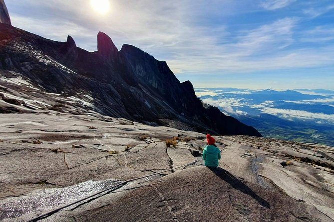
The granite cooled underground roughly ten million years ago, which is very young for a mountain of this size. That is why the summit is bare polished rock: there has not been time for soil to form on it.
4. Its official height changed in 1997
A satellite survey fixed it at 4,095 m, correcting the previously published 4,101 m. Older books, signs and t-shirts still carry the old number.
5. It is the highest mountain between the Himalayas and New Guinea
Not just in Borneo, and not just in Malaysia. Nothing higher stands between those two ranges.
6. Glaciers shaped the summit you walk across
The polished granite slabs above the checkpoint were smoothed by ice during the last ice age, on a mountain six degrees north of the equator.
7. The park was Malaysia’s first World Heritage Site
Listed in 2000, across 75,370 hectares, and listed for its plants rather than for the summit.
8. More plant species live here than in some continents
Between five and six thousand, plus 326 bird species and over a hundred mammals, inside one park boundary. The range of altitude is what does it.
9. The world’s highest via ferrata is bolted to it
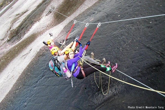
Mountain Torq’s Low's Peak Circuit reaches 3,776 m and is certified by Guinness World Records. It was built in 2007 and rebuilt after the earthquake.
10. You cannot climb it alone, by law
Park regulations require a registered mountain guide for every climber. Guide ratios are fixed too: one to five on the standard summit trail, one to three on the Kota Belud.
11. The number of climbers is set by beds, not by trail width
About 130 permits a day, derived from how many people can sleep at 3,272 m. The trail could take more; the huts cannot.
12. An earthquake permanently changed the route in 2015
On 5 June 2015 eighteen people died on the mountain, the Donkey Ears peaks were damaged, and the Mesilau trail closed for good. The summit trails climbers use today were established afterwards.
What you will notice, and what you will walk straight past
You will notice the cold, the steps and the moment the forest stops. What you will walk past, in the dark and on tired legs, is most of what makes this mountain unusual. The pitcher plants are beside the trail on day one if you look down. The ice-scoured gullies are under your feet on the summit plateau. The Donkey Ears are on your right as you come off the top, and if you turn round at the right moment you can see the notch the earthquake put in them.
None of that changes whether you finish. It does change what you remember, and it costs you nothing to know it before you set off rather than after you get home and read about it.
The facts that change your plans
| Fact | What it means for you |
|---|---|
| Permits capped at about 130 a day | Book the date months out, before flights |
| A guide is compulsory | There is no cheaper unguided option to compare against |
| Sabah Parks reservations are non-refundable | Every package here follows suit; fix your dates first |
| The Mesilau trail is closed | Ignore any advice that offers it as a second route |
| The summit is bare polished granite | Wet rock changes the summit push more than rain does |
| 4,095 m, reached before dawn | Pack for cold, not for the tropics |
Six of the twelve facts above have direct consequences for how you book and what you carry.
Three of those facts are worth a second look
Why a young mountain has a bare summit
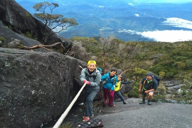
Ten million years sounds ancient until you set it against the Himalayas, which have been rising for roughly five times as long. Kinabalu is a young intrusion that erosion has only recently uncovered, and soil has not had time to form on the exposed granite. That is why the top of the mountain looks like a pavement rather than a mountainside, and why the last hour of the climb has no path in the usual sense — just rock, a rope and a painted line.
Why glaciers matter to a climb six degrees from the equator
During the last ice age the summit plateau carried ice, and the ice did what ice does: it planed the granite smooth and gouged out the gullies that now drain it. Every climber who has slipped on those slabs in the wet has met the consequence directly. It is also why the summit area has that curious scooped, polished look that photographs badly and reads unmistakably in person.
Why the permit cap is a bed count
The trail could take far more than around 130 people a day. The huts at 3,272 m cannot, and since everybody who summits sleeps in one of them the beds decide the number. That single fact explains the booking lead times, the price, the non-refundable terms and why a date is worth locking before a flight.
The one fact worth acting on today: permits and hut beds go together and they go early. How far ahead to book is the difference between climbing in March and climbing in November.
None of this is why people come, of course. They come because the light arrives at about half past five over a sea of cloud and there is nothing higher for two and a half thousand kilometres. The rest is planning. If you want the practical version, Mount Kinabalu guided tours set out what each fare covers, and the climbing page covers what the mountain actually asks of you.
Facts are the easy part; a date with a permit on it is the hard part. Permits, fares and booking windows, the trail by altitude and the month to pick are each a click away — or compare every climb on Mount Kinabalu Tours.
Climbs to the facts above
The via ferrata and the extra acclimatisation night are the two options most people do not know exist until they are looking.