Mount Kinabalu Trail by Trail: Timpohon Gate to Low's Peak
Kinabalu Park Headquarters, about 1,563 m
Nothing starts until you have registered at Kinabalu Park Headquarters. A passport or original identification is checked, permits are issued against names, and your mountain guide is assigned. It is also the last place with reliable everything — food, a shop, a bathroom you would choose. The botanical garden is ten minutes’ walk away and worth the half hour if your schedule allows.
Timpohon Gate, 1,866 m
A short transfer above Park Headquarters, and the point at which walking begins. Packed lunches are handed out here. The gate is a physical barrier with a register, and nobody walks through it without a permit and a guide. From here the trail runs 8.5 km to the summit.
The montane forest, 1,900 to 2,600 m
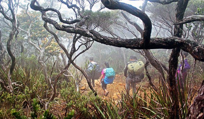
The first hours climb through the band of forest the park was largely listed for. It is mossy, dripping and close, full of pitcher plants and stunted trees bent by the wind. Shelters sit at intervals with water, and they are where groups regroup and eat. This is where the pace gets set, and a guide walking to the slowest person is doing the thing that gets everyone up.
Layang-Layang and the tree line
Somewhere above 2,700 m the forest starts to give up. The trees shorten, the moss thickens, and the views open out east across the Crocker Range whenever the cloud allows. Most climbers notice the cold here for the first time, and it is a good place to put on the layer you have been carrying since the gate.
Panalaban, 3,272 m
The huts, and the reason the permit is capped. Dinner is served from about half past four in the afternoon, lights go out at eight, and you will be woken at half past one. Which building you sleep in is your operator’s allocation:
- Laban Rata Resthouse — the main building, unisex shared dormitories, and the canteen everybody eats in.
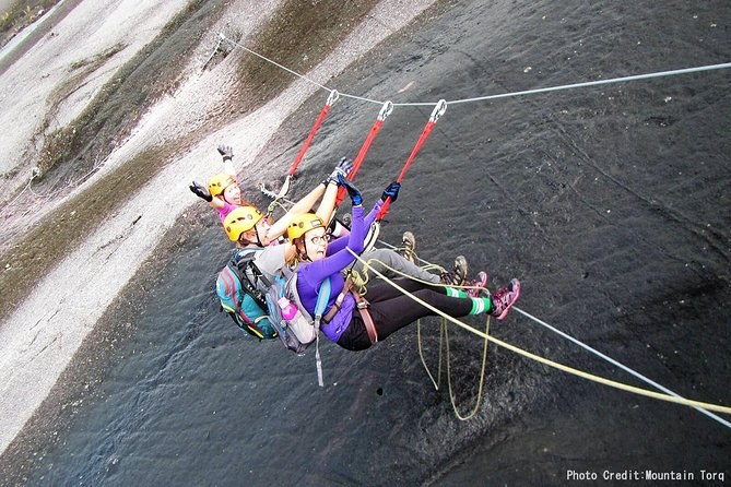
- Pendant Hut — the via ferrata hut, where the compulsory safety briefing happens at about half past three.
- Panalaban Hostel and Lemaing Hut — further accommodation at the same level.
Eat the dinner even if the altitude has taken your appetite, and drink more water than feels reasonable. There is more on how altitude behaves here on the climbing page.
Sayat-Sayat checkpoint, 3,668 m
About an hour above the huts, and the last checkpoint before the summit plateau. Every climber signs in. It is also the decision point: if the weather has turned or a group is moving too slowly, this is where a guide turns people round. Above it the vegetation stops entirely and the mountain becomes bare granite.
The granite slabs
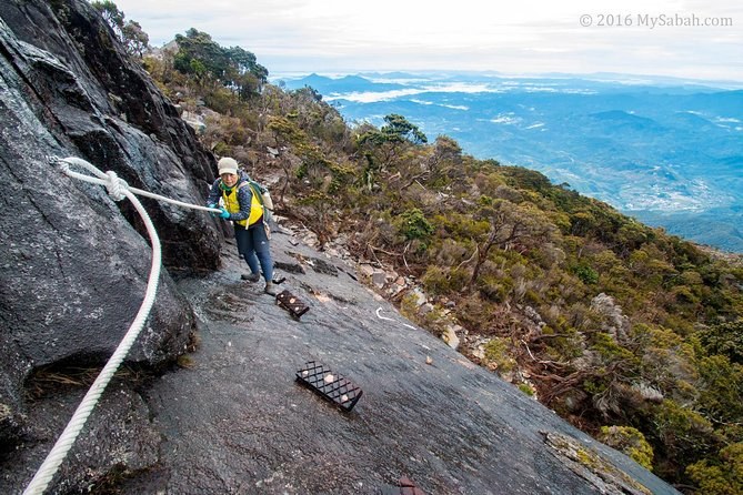
An hour of open rock at a gentle angle, in the dark, with a fixed white rope running across it. You hold the rope rather than clip to it. The surface was polished smooth by glaciers during the last ice age, which is why it feels more like a pavement than a mountainside, and why wet granite changes the climb more here than anywhere else.
Low's Peak, 4,095 m
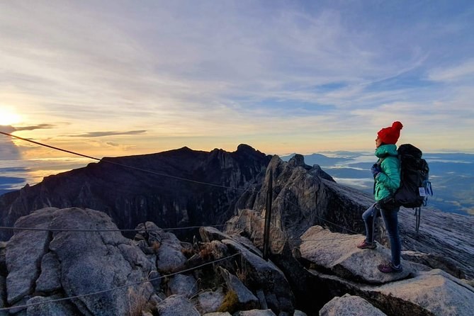
The summit, and the highest point between the Himalayas and New Guinea. You reach it before dawn, get perhaps twenty minutes, and watch the light come up over a sea of cloud with Sabah underneath it. Sir Hugh Low, whose name the peak carries, reached the plateau in 1851 and judged the peak itself “inaccessible to any but winged animals”. John Whitehead climbed it in 1888.
What it is like underfoot
You will spend most of day one on steps. They are stone and timber, cut into the hillside, uneven, and often wet. Tree roots fill the gaps between them. It is not scrambling and it needs no technique, but it is relentless in a way that a graded path never is, and it is why your calves know about it long before your lungs do.
Above the huts the surface changes completely. The steps stop and the granite begins, and for the last hour you are walking on rock at an angle gentle enough to stand on and smooth enough to slide down. Hold the fixed rope, put your feet flat rather than on their edges, and take the descent across it slower than you think you need to.
The two summit trails
Above the huts the route splits, and which one you walk is decided for you.
| Trail | Trail length | To the summit | Daily cap | Guide ratio |
|---|---|---|---|---|
| Ranau Trail | 1,270 m | about 2.8 km | none | 1 to 5 |
| Kota Belud Trail | 1,100 m | around 2.8 km | 30 climbers | 1 to 3 |
| Mesilau Trail | — | — | closed since June 2015 | — |
Trail data as published by one of the operators running climbs here. The Ranau Trail became the standard summit route after the 2015 earthquake; the Kota Belud Trail opened on 9 December 2016.
The trail that is no longer there
Until the morning of 5 June 2015 there were two ways up Mount Kinabalu, and Mesilau was the longer, greener, quieter one. The earthquake that day killed eighteen people on the mountain, damaged the Donkey Ears peaks and left the Mesilau trail inaccessible. It has never reopened. Plenty of published advice still describes it, which is the single best test of whether what you are reading has been updated in the last decade. What happened that morning reshaped the whole route.
Shelters, water and where groups actually stop
The Timpohon Trail is punctuated by shelters — simple roofed platforms with water, spaced closely enough that you are rarely more than half an hour from the next one. They matter more than they look. They are where a group closes up, where you eat the packed lunch you collected at the gate, and where a guide gets a quiet read on who is struggling.
Fill your bottle at every one rather than at every second one. Altitude dehydrates you faster than the effort does, and the single most common cause of a bad night at the huts is arriving already short of water. The last reliable water is at the huts themselves; above them there is none at all until you are back down.
Coming down
The same way, in daylight, on legs that have been awake since half past one. This is the part almost everybody underestimates, and it is why the second pair of shoes in the kit list is not a luxury. Guide overtime after 4pm is charged at MYR 15 per group per hour, so a slow descent has a price as well as a cost.
Whichever trail your group is allocated, the fare covers the same things. The differences between the Mount Kinabalu tickets are format and length, not route — and what each one includes is the more useful comparison.
Walk it on paper first and the real thing holds fewer surprises. Permits, fares and booking windows, the trail by altitude and the month to pick are each a click away — or compare every climb on Mount Kinabalu Tours.
Climbs that walk this trail
Three formats, one route. What changes is where you sleep and how long you get either side of the summit.